The Government Builds an
Island

 Originally
the Estuary was a very shallow body of water--about 2 feet deep at low
tide. Dredging projects to deepen ship channels began as early as 1859
and have continued ever since. The problem of what to do with the dredge
spoils--the sand, rock and mud removed from the channel--has plagued all
dredging projects. The disappearance of the marshes and changes in the
shoreline that you see on this map are largely the result of the need to
dispose of dredge spoils.
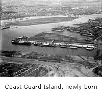
In 1916, the Army Corps of Engineers, which had done much of the
dredging, created a 100-acre island of dredge spoils in Brooklyn Basin.
A dispute arose regarding ownership with both Oakland and Alameda laying
claim. The courts decided in Alameda's favor. Alameda then sold part of
it to the federal government which, in 1934, built a Coast Guard and
Customs station on the island.
Deborah Cooper
Oakland Museum of California
 "Walk Along the Water"
© Oakland Museum of California, used with permission.

 Explore this Topic:
History of
Coast Guard Island - US Coast Guard
 back to history map