|
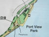
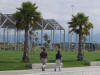
 Middle Harbor Shoreline Park is a new 38-acre complex adjacent to the
existing Port View Park. Located at the Middle Harbor
Basin, the complex includes new facilities at Point Arnold and the
Western Pacific Mole. Working together with the West Oakland
community, the Port conceived and built the park. Middle Harbor Shoreline Park is a new 38-acre complex adjacent to the
existing Port View Park. Located at the Middle Harbor
Basin, the complex includes new facilities at Point Arnold and the
Western Pacific Mole. Working together with the West Oakland
community, the Port conceived and built the park.
The park is owned and operated by the Port of
Oakland.
The park provides a special place for learning about
the history and maritime activities of the area and an opportunity for
viewing shoreline wildlife in native habitats.
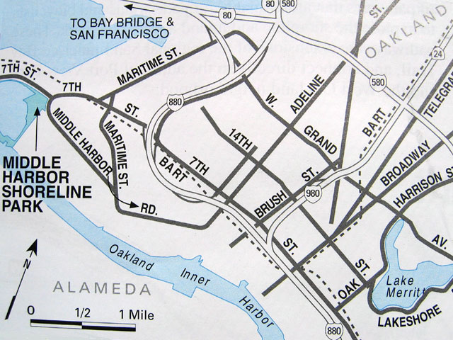
The park is located at the intersection of 7th St. and
Middle Harbor Rd.
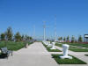
The park complex surrounds Middle Harbor Basin and offers a wide range of engaging opportunities
including:
-
spectacular views of the bay and shoreline,
shorebirds, nearby maritime operations, San Francisco and Oakland
skylines, and marine traffic at the estuary mouth;
-
a dramatic observation tower;
-
picnic and barbeque facilities - no
reservations.
-
parking, restrooms, and water fountains;
-
historical exhibits;
-
an amphitheater;
-
free viewing scopes;
-
fishing
pier and platforms;
-
the only beach in Oakland; and
-
nearly three miles of pedestrian
and bike paths, some of which are part of the
Bay
Trail.
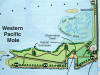
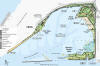 This
detailed
park map, developed by East Bay Regional Parks, shows the park's overall design and
highlights many of its features. The map is a PDF file, so you can
zoom in for great detail. This
detailed
park map, developed by East Bay Regional Parks, shows the park's overall design and
highlights many of its features. The map is a PDF file, so you can
zoom in for great detail.
The
Port of Oakland's page on Middle Harbor Shoreline
Park describes park features, activities, and
trails as well as the area's history,
environment, and maritime context.
Port Contact: For information about Middle Harbor, including its
environmental education programs, contact Ramona Dixon at (510) 627-1634 or email at
rdixon@portoakland.com.
Park Reservations
The park is owned and operated by the Port of
Oakland.
The Port does not accept picnic reservations - picnic areas are
available on a first-come basis. Waterfront Action cannot make
reservations for you.
Park Grand Opening
 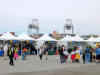
Click thumbnails for larger view:
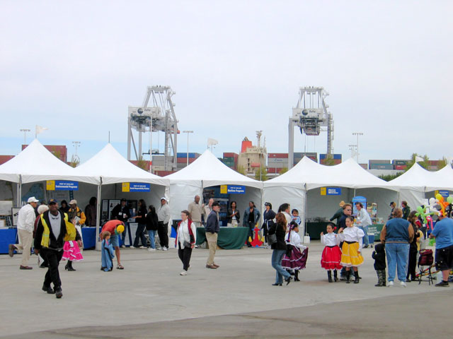
The September 18, 2004 Grand Opening of the park was
well-attended by the community and included information and food booths,
music and dance performances, a formal dedication ceremony. Waterfront Action was active at a
booth, distributing waterfront access maps and responding to questions
from the public.
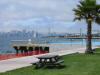
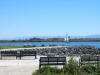
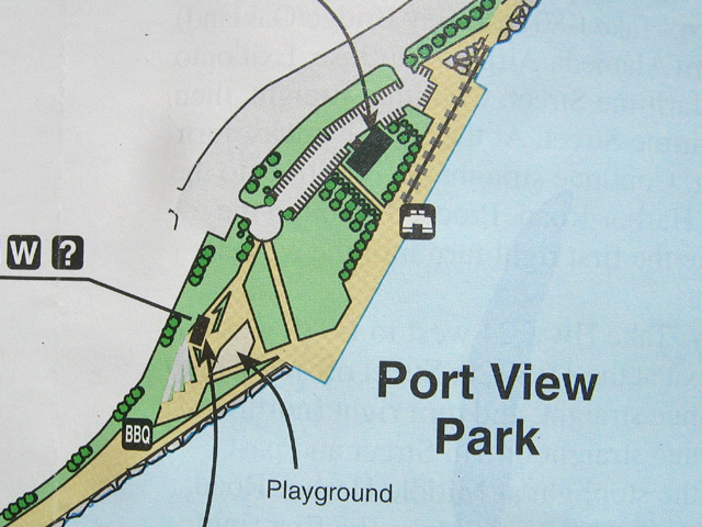
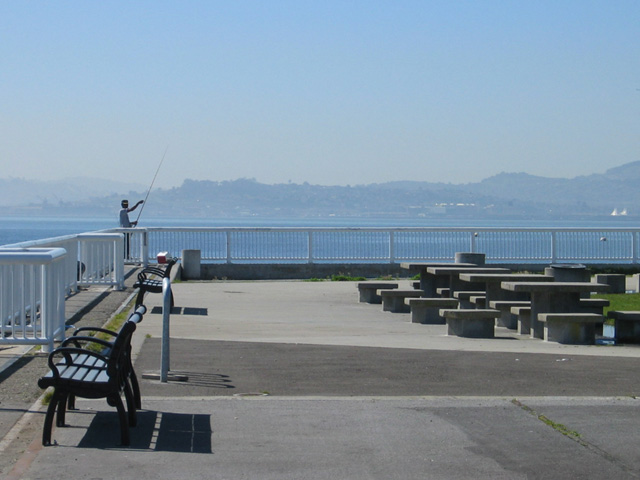
Port View Park Area

Port
View Park was extensively renovated after the 1989 earthquake and has
been open since 1995.
The location affords great views maritime operations at the Ben Nutter
terminal and of the bay.
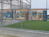
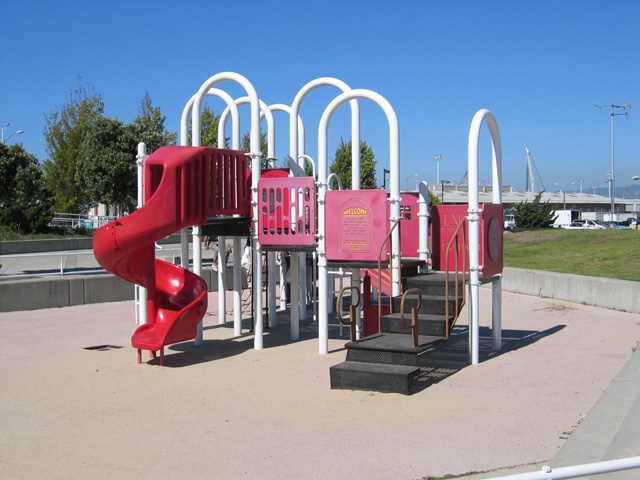
  The
central portion of the park includes walkways, benches, and picnic
tables, a fishing platform and children's play structure. The
central portion of the park includes walkways, benches, and picnic
tables, a fishing platform and children's play structure.


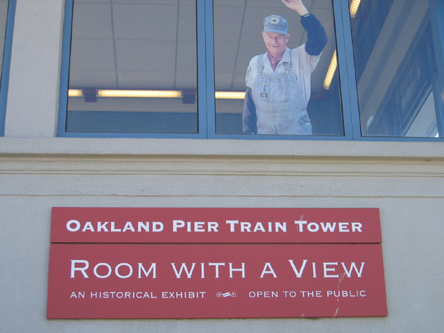
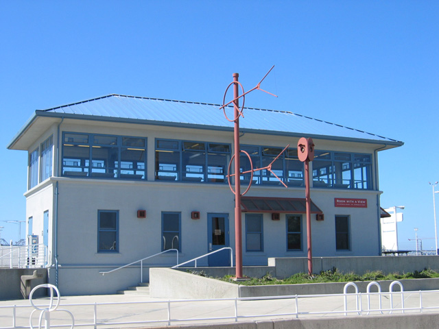
  A
special park feature is the train tower historical exhibit: "Room with a
View". A
special park feature is the train tower historical exhibit: "Room with a
View".
A section of the Bay Trail extends west from Port
View Park to the Point Arnold area of Middle Harbor Shoreline Park.
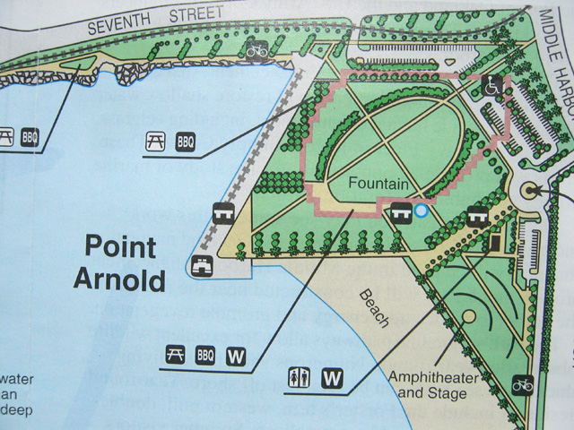
Point Arnold Area
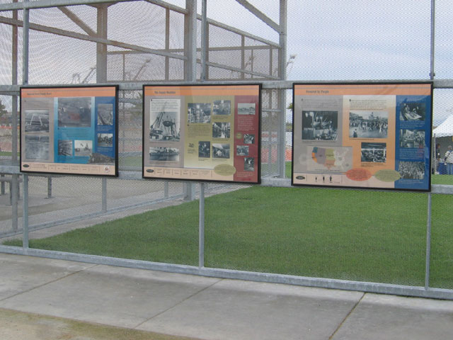
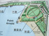 Point Arnold was the site of the former Oakland
Naval Supply Depot, a major supply center for the Pacific Fleet
throughout the past 60 years. The
history of the area is described in a
flyer, available at park entrances. Point Arnold was the site of the former Oakland
Naval Supply Depot, a major supply center for the Pacific Fleet
throughout the past 60 years. The
history of the area is described in a
flyer, available at park entrances.
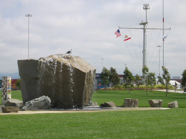
 Point
Arnold offers wide paths, picnic tables, and a fountain that delights
both people and shorebirds. Point
Arnold offers wide paths, picnic tables, and a fountain that delights
both people and shorebirds.
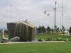
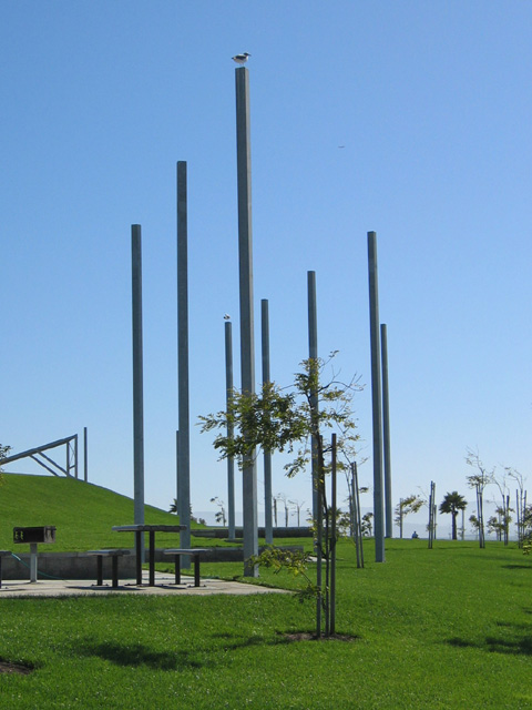
Architectural features include masts and a "ghost structure" that echoes the
roofline shape of the Naval Supply Depot historically located on the site.
Within the ghost structure, signage describes the history of the depot.
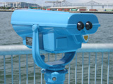 Great views of San Francisco Bay and
city skylines are aided by free binoculars,
including one set with height appropriate for children or wheelchair users. Great views of San Francisco Bay and
city skylines are aided by free binoculars,
including one set with height appropriate for children or wheelchair users.
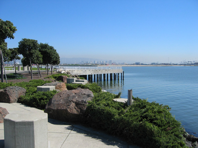
Other area features:
From the Point Arnold Area, a walking trail and
roadway extends south past coves and a salt marsh restoration area,
reaching the Western Pacific Mole area.
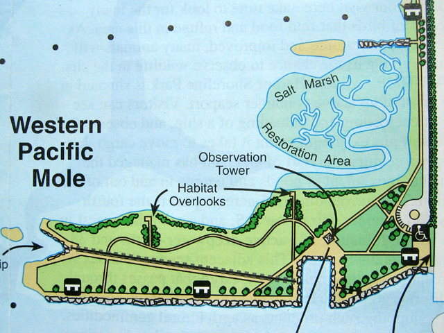
Western Pacific Mole Area
This
developing region opened to the public at the September 18, 2004 Grand Opening of
Middle Harbor Shoreline Park.
Area features:
-
Handicap parking only - no general parking
-
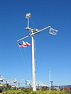
Observation tower
-
Paths, benches
-
Native plantings and habitat restoration
-
Habitat overlooks
-
Viewing area for maritime operations at Hanjin
Terminal
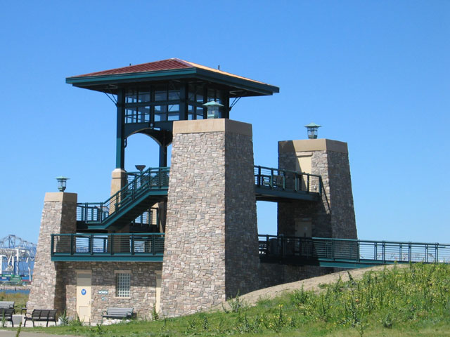
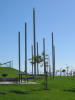
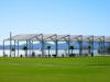
  The dominant feature of the Western Pacific Mole
area is the striking Chappel Hayes observation tower, which provides
spectacular views of the surrounding landscape and San Francisco
Skyline. The tower incorporates elevators, informative signage,
viewing scopes, and rest rooms. The dominant feature of the Western Pacific Mole
area is the striking Chappel Hayes observation tower, which provides
spectacular views of the surrounding landscape and San Francisco
Skyline. The tower incorporates elevators, informative signage,
viewing scopes, and rest rooms.
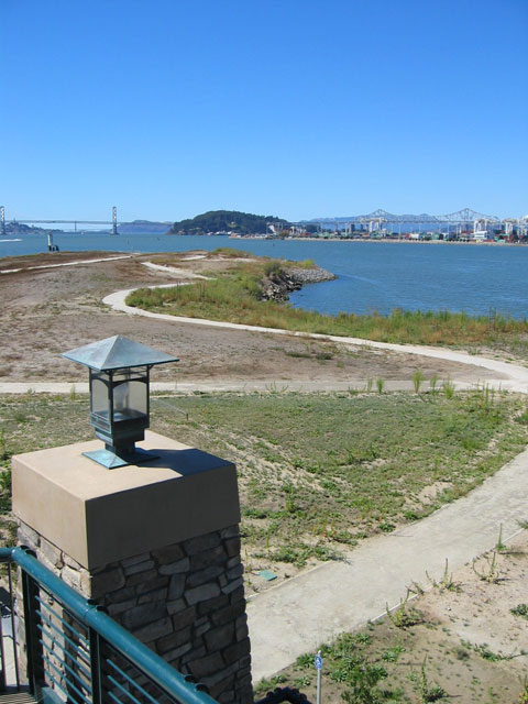
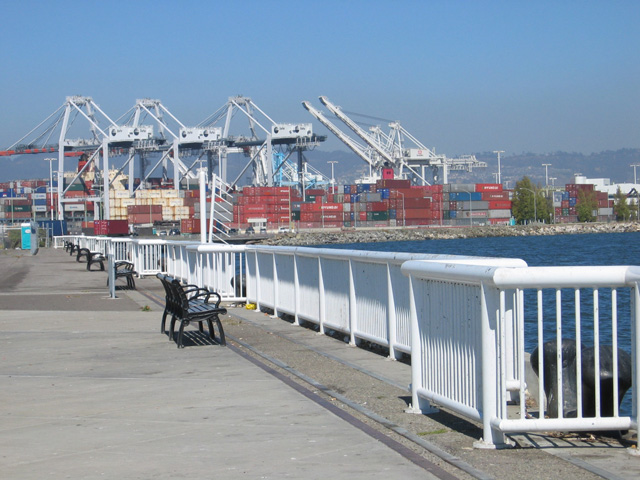
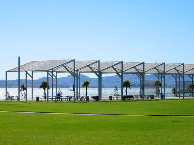
Benches dot the shoreline, offering relaxing
opportunities for viewing birds and marine traffic at the mouth of the estuary.
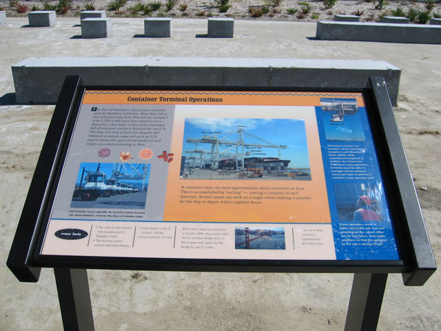
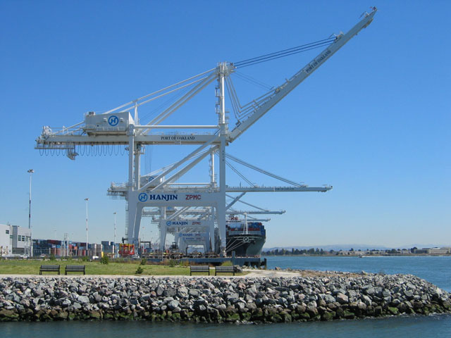
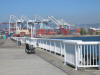
 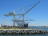 The adjacent Hanjin Terminal uses huge
super-Panamax cranes that cost about $7 million each. The cranes
came from Shanhai, China by ship and are so large that they passed under
both the Golden Gate and Bay Bridges with only a few feet to spare. Crane operations can be
studied close-up from a convenient viewing area
that provides benches and informative signage. The adjacent Hanjin Terminal uses huge
super-Panamax cranes that cost about $7 million each. The cranes
came from Shanhai, China by ship and are so large that they passed under
both the Golden Gate and Bay Bridges with only a few feet to spare. Crane operations can be
studied close-up from a convenient viewing area
that provides benches and informative signage.
top^
|

 Map
Map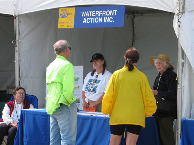


 amphitheater/stage